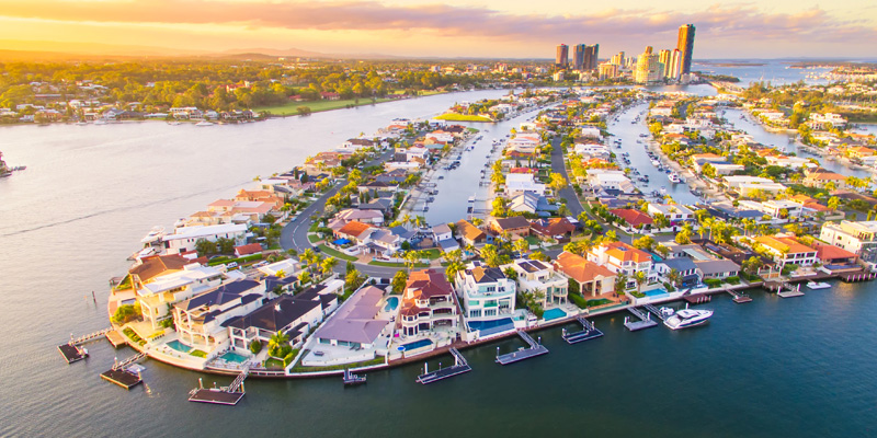
Sitting within the sheltered waters of the Moreton Bay Marine Park is a string of inhabited islands that many Queenslanders have yet to truly discover. On a still afternoon the Southern Moreton Bay Islands (SMBI) look serene, quietly settled into their channels like small coastal communities suspended between old Queensland charm and the edge of rapid growth. Russell, Macleay, Lamb and Karragarra offer the promise of affordable blocks, soft breezes through the mangroves and a life that feels comfortably removed from the increasingly intense sprawl on the mainland. It is, in many ways, an island paradise - but one that is beginning to feel the weight of modern growth pressing at its edges.
Yet beneath that beauty is a far more complicated reality. The islands are carrying a legacy of historical planning that has never fully been reconciled, and the pressures of modern population growth are colliding with infrastructure systems that are stretched, fragile and deeply expensive to maintain. The question is no longer whether the islands are unique. They are. The harder question is whether they can sustain the weight now placed upon them.
The Subdivision That Started Everything
The Southern Moreton Bay Islands sit within Redland City, not the Gold Coast, but they lie close enough that many South-East Queensland buyers treat them as part of the same coastal sphere. That nearness shapes expectations about lifestyle, infrastructure and accessibility, even though the islands operate under a very different set of physical and logistical realities.
The Southern Moreton Bay Islands still live in the shadow of a planning decision made fifty to sixty years ago. During the 1960s and 70s, large sections of the islands were subdivided into thousands of small residential lots and marketed aggressively across Australia and overseas. The lots were drawn long before there was any realistic capacity to service them. Roads existed on paper but not on the ground. Environmental constraints were poorly understood. Sewerage, stormwater, emergency access and power networks were largely or entirely absent.
Over time the Queensland Government moved to clean up the mess left by those early subdivisions. Titles were corrected, boundaries regularised and historic inconsistencies resolved so that the islands could be brought under proper modern planning controls. That era of uncontrolled subdivision is no longer occurring, yet the underlying pattern still defines the physical landscape today. The thousands of small lots remain on the titles register. The road grid remains in awkward, fragmented strips. And councils and state agencies are still trying to retrofit infrastructure across a settlement footprint that was never designed for water-based communities with limited evacuation and fragile service networks.
The result isn't a present-day policy failure, but an inheritance that cannot be unwound without rewriting property rights on a scale that no government has ever shown an appetite for.
A Community Growing Faster Than Its Infrastructure
In recent years the islands have shifted from "hidden secret" to "push point" for South-East Queensland's affordability crisis. People have arrived seeking a seaside life that no longer exists on the mainland at comparable prices. Remote work has softened daily commuting, and the appeal of buying an actual house rather than an apartment has drawn new families, singles, and downsizers into what was once a quieter island demographic.
The population isn't exploding, but it is steadily increasing, and the composition is changing in ways that matter. Ageing residents rely more heavily on health services and emergency access. Families need connections to high schools, sports facilities and employment. Trades, deliveries, and construction crews are constantly moving between the islands and the mainland. Every one of these movements must be carried by the same finite transport spine: the ferries and barges.
Ferries, Barges and the Constant Balancing Act
Life on the islands hinges on a single transport system with no redundancy. When the ferries are running smoothly, island life feels manageable and peaceful. When weather hits and when fog or winds disrupt operations, the vulnerability becomes unmistakable.
Everything from grocery runs to connecting emergency treatment relies on these vessels. Building materials. Trades. School trips. A simple cold front or a mechanical issue can cascade into major delays. The recent upgrade of terminals has improved safety and accessibility, but the underlying fragility remains: one system, one point of failure, and thousands of people whose daily lives depend on it.
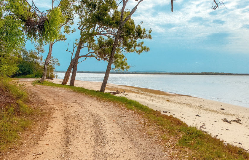
Even on the islands themselves the road network reflects its improvised origins. Many streets are sealed and perfectly serviceable, but others are narrow, uncurbed, steep or prone to pooling after heavy rain. In some undeveloped pockets the "roads" are little more than rough dirt alignments, weathered into deep ruts and soft sand, so marginal that they would challenge almost any vehicle or driver regardless of experience.
Bushfire, Storm Tide and the Geometry of Island Risk
The islands face a unique combination of hazards. Vegetated pockets and dry seasons create bushfire risks that become acute in certain parts of Russell and Macleay. Coastal inundation affects low-lying land, especially in older subdivided areas close to the water table. These risks compound because of the islands' physical isolation. A suburb on the mainland may have multiple evacuation routes; an island does not. Everything narrows to a handful of jetties, a few last-resort emergency beach-landing points, and a small core fleet of ferries, as well as other vessels that may be called upon to assist in a widescale evacuation, but that cannot always operate as conditions deteriorate.
Evacuation planning for the islands is a fundamentally different undertaking. It must consider weather, tides, vessel availability, passenger capacity, and the reality that some residents will always wait too long to leave. In a severe fire or a fast-moving storm surge, time collapses quickly. Emergency access becomes not just difficult but sometimes impossible.
This is not a sign of incompetence or neglect. It is a simple truth of island living in a landscape increasingly shaped by climate extremes.
The Sewerage Problem That Will Not Go Away
One of the most significant long-term challenges on the Southern Moreton Bay Islands is wastewater. There is no reticulated sewerage network. Every property relies on some form of on-site treatment system, usually septic or a modernised secondary treatment unit.
This arrangement can work for small rural communities with large lots and deep soil profiles. The islands, however, contain thousands of small blocks laid across sandy soils and shallow water tables. When more homes are added, the cumulative environmental load increases. Older systems may fail or leak undetected. High rainfall can stress absorption. Small lots leave little room for replacement systems. And every new house adds another individual point of risk.
Building a full sewerage network would be an enormous engineering and financial challenge. Marine pipelines, pumping stations, environmental protections and multi-island networks would cost far beyond what the local rate base could ever fund.
Wastewater therefore becomes one of the most important and uncomfortable truths about the islands. It is not catastrophic today, but it is a sustainability question that cannot be ignored indefinitely.
Social Infrastructure and the Day-to-Day Strain
The islands have heart. Community groups, volunteers, local cafés, corner shops and neighbours who look out for one another form a social fabric that many mainland suburbs would envy. But the essentials of modern life still require the mainland. High schools, hospitals, aged care, specialists, emergency departments, government services, major retailers and most workplaces all sit across the water.
For mobile residents, ferries are simply a routine. For those with chronic illness, disabilities, limited income or limited transport, the dependency becomes much heavier. As the population grows, the gap between service need and service availability is becoming sharper, not softer.
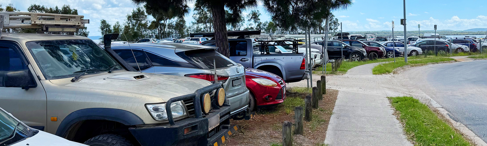
The Carparking Bottleneck That Sets the Tone
For many island residents, the daily challenge begins well before they step onto a ferry. The mainland carparks at Redland Bay struggle to keep pace with demand, and finding a space can become the most stressful part of the journey. Commuters often arrive to find the bays already close to capacity, forcing them to circle for a vacancy or park well away from the terminal and walk. By late morning the spillover pushes cars into surrounding verges and any informal gaps drivers can safely claim. What should be a simple handover from car to ferry instead becomes a daily contest for limited space.
While infrastructure upgrades are underway, many residents question why so much emphasis is being placed on carparks when the real pressure sits with the transport system itself. To them, adding more parking may ease today's congestion, but it does little to strengthen ferry capacity, improve timetable resilience or address the fragility of relying on a single transport spine.
The bottleneck is more than an inconvenience. It illustrates how quickly demand has outpaced the systems designed to support island life. For many, the carpark experience is the first reminder that the islands' growth has outstripped the infrastructure intended to carry it.
The Shadow of the Bridge Debate
No discussion about long-term transport on the Southern Moreton Bay Islands escapes the question of a bridge connecting to Russell Island. It surfaces regularly in community debates and political conversations, fuelled by frustration with ferry dependence and the belief that a fixed connection could finally break the cycle of isolation. Supporters argue that a bridge would stabilise transport, attract investment and give emergency services the reliability the islands currently lack.
But the idea is far from simple. The engineering, environmental impacts, and enormous cost create a political hesitation that has persisted for decades. Governments have historically sidestepped the issue, wary of committing to a project that would reshape the islands in ways both positive and irreversible. Whether the prospect remains distant or eventually gains momentum, the bridge debate hangs over every conversation about the islands' future - a reminder that the current system, for all its routine and resilience, may not be sustainable forever.
A Political Problem No-One Wants to Own
The islands also face a political dimension that rarely gets stated openly. Infrastructure on islands is expensive. Very expensive. For decades, politicians have balanced the cost of island upgrades against the relatively small number of votes returned from those communities. Investment has historically favoured the mainland, where benefits reach more people. The result is a cycle where the islands receive upgrades in bursts but rarely at the scale needed to reshape their long-term trajectory.
If population growth continues, that political reluctance will eventually collide with real-world unsustainability. At some point the cost of doing nothing may exceed the cost of action, but history suggests action only comes when pressure reaches a breaking point.
So, Are the Islands a Disaster Waiting to Happen?
The Southern Moreton Bay Islands are not a disaster today. They are functioning communities with strong identity, undeniable charm and genuinely passionate residents. But they also sit on a knife-edge.
They carry a subdivision pattern never designed for sustainable island growth. They depend on a single transport spine that has no redundancy. They face bushfire and storm-tide hazards that are magnified by isolation. They operate without town sewerage in a landscape of small lots and fragile soils. They juggle demographic pressures and service shortages that no mainland suburb of similar population would tolerate.
Whether the islands become a planning disaster or a model of smart coastal management depends entirely on decisions made now. It will require honest planning, serious investment, a long-term wastewater strategy, stronger hazard management, reliable transport, and political will that has historically been missing.
The islands are beautiful. They are loved. They have enormous potential. But beauty alone cannot resolve the structural weaknesses beneath them. Without a coordinated plan, the risks will continue to deepen. With one, the islands could finally move beyond the legacy of their past and grow into sustainable communities worthy of their extraordinary setting.
If anything will determine their fate, it is the willingness of governments, planners and residents to acknowledge that the calm waters around the islands hide one of the most complex infrastructure puzzles in Queensland — and that time is tightening, not loosening, around the need to solve it.
You might also like


Disclaimer: Every effort has been made to ensure the accuracy of the information provided, but we make no guarantees regarding its completeness or reliability. The data is presented for general informational purposes only and does not constitute financial, investment, or legal advice. We are not liable for any errors, omissions, or consequences arising from its use. Users should verify details with relevant sources and seek professional advice where appropriate for the most accurate and up-to-date guidance.